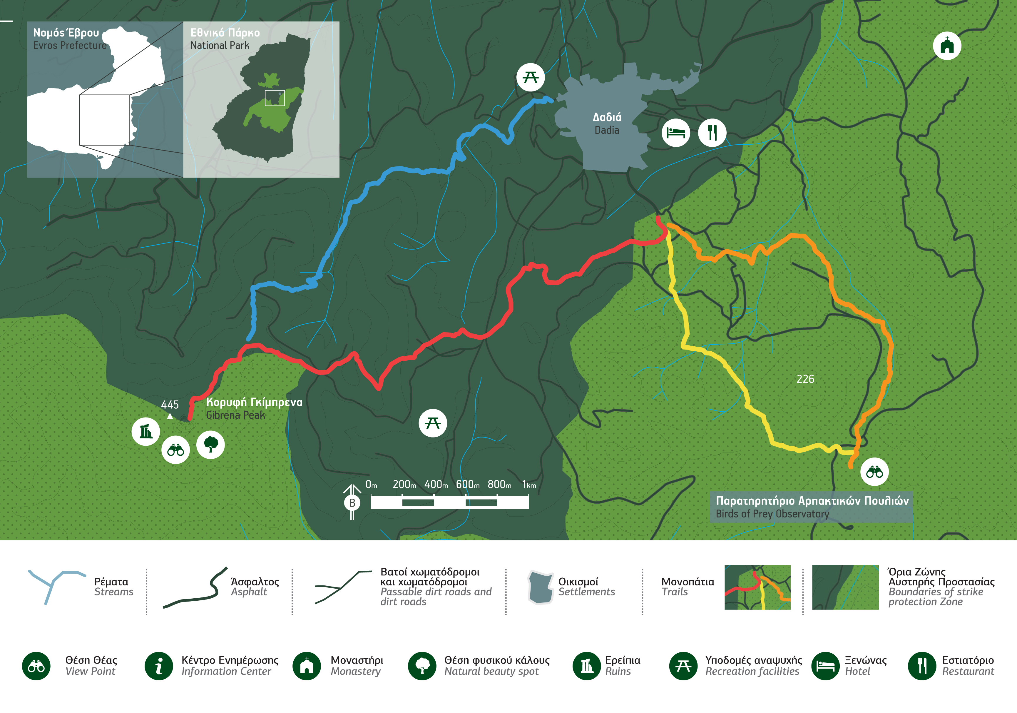
Trails
Crossing the trails of the Dadia–Lefkimi–Soufli Forest National Park you will have the chance to discover the mysteries of the forest and enjoy its breathtaking landscapes. The trails vary in difficulty, duration and places of interest. For a convenient tour, you should have trekking shoes, a first aid kit and water, while binoculars are necessary for bird-watching
Orange trail
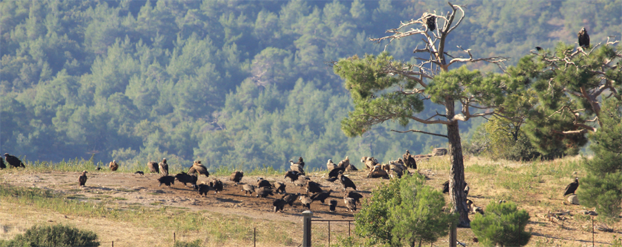
This trail is of low difficulty with gentle slopes. It begins from the Information Centre and leads to the Birds of Prey observatory, where you will have the chance to watch rare vultures and eagles eating in their natural habitat. It will take you about 60 minutes to complete the route at a leisurely pace, following old cart roads that pass through the dense forest, whereas clearings and ravines with rich vegetation offer outstanding landscapes. Moreover, you will discover tracks of big and small mammals, while along the trail you may observe Black Storks, Short-toed Eagles, Northern Goshawks and Buzzards flying above the rocks amongst plenty of other birds.
Yellow trail
The yellow trail leads from the Birds of Prey Observatory back to the Information Centre. It takes 45 minutes and the route is slightly downhill. Following the old cart road that used to connect Dadia to the fields near Lyra stream, you will have the chance to enjoy the wildflowers growing in the clearings of the forest and listen to the birds singing all along the way. If you have a sharp eye, you may also spot Chaffinches, Great Tits, Song Thrushes and Woodpeckers flying around.
Red trail
The red trail begins from the Information Centre and leads to the “Gibrena” peak, at an altitude of 520 m., through an uphill route of moderate difficulty. If you decide to follow this 150-minute trail, you will definitely feel rewarded by the constantly changing landscape of Black Pines and Oak trees. Just before reaching the top of the hill you will find the ruins of a Byzantine fortress and you will enjoy the panoramic view to the whole protected area, while watching birds of prey and vultures flying right above you!
Blue trail
The blue trail leads from the “Gibrena” peak back to the Information Centre. It takes 90 minutes and the descent is of moderate difficulty. Following the old trails through the forest, you may spot oaks, hornbeams, strawberry trees, phylireas, tree heaths and a number of other bushes and wildflowers. Following Diavolorema River, which flows from the mountains through the small but fertile land of Dadia, you will reach the fields, at the fringes of the forest, where birds of prey may seek their food. At the end of the route, you will find a small cave, which used to serve as a sheepfold, to end up at “Tsami”, a recreation area, with its famous spring, at the west of the Dadia settlement.